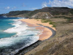
| Fernando
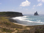
de Noronha is an archipelago of about 21 islands and rocky islets. The main island
is roughly 6.25 miles long and just over a mile wide /10kms x 1.7kms. The area
of the archipelago is 26sq kms including land and sea. Of this about 70 percent
is a protected Marine National Park while the remaining 30 percent is a protected
environmental area. It was declared a UNESCO World Heritage site in 2001. The
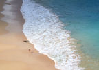
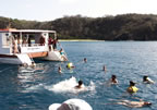
number of visitors is restricted and everyone has to pay an 'environment protection
tax' based on the number of days spent on the island. IBAMA* officers are everywhere,
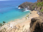
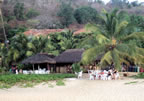
litter is more or less non existent, and swimming is allowed only on a few beaches.
Sun-block creams and the use of shoes is restricted in some places so the beach
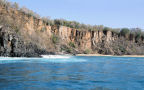
pools are not contaminated. The
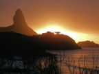
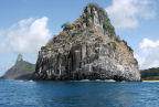
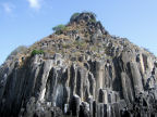
group has a volcanic origin although there is no sign of a crater and the base
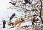
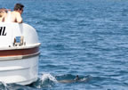
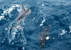
is approximately 2500 feet/ 762 m below sea level. Much of the fauna is marine
and there are numerous species of sea birds. The one terrestrial mammal, a small
cavy was introduced from the mainland. The
discovery of the islands is attributed to different people by individual historians.
The first appearance on a map is said to have been in 1502 when they were called
Ilha da Quaresma [or Lent Island] the first description was made by the Italian
Americo Vespucio [Amerigo Vespucci] who was travelling with an expedition commanded
by the Portuguese navigator Gonçalo Coelho. The name is derived from Fernão
de Loronha who financed the expedition. The
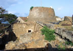
islands were first occupied by the French East India Company in 1736 and then
in the following year they were re-taken by the Portuguese. Occupation and development
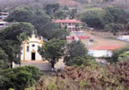
began with the construction of the settlement of Vila dos Remédios. Today
the islands are part of the administration of the Brasilian State of Pernambuco. *IBAMA
/ Instituto Brasileiro de Meio Ambiente e dos Recursos Naturais Renováveis
[Brasilian Institute of the Environment and Renewable Natural Resources] |